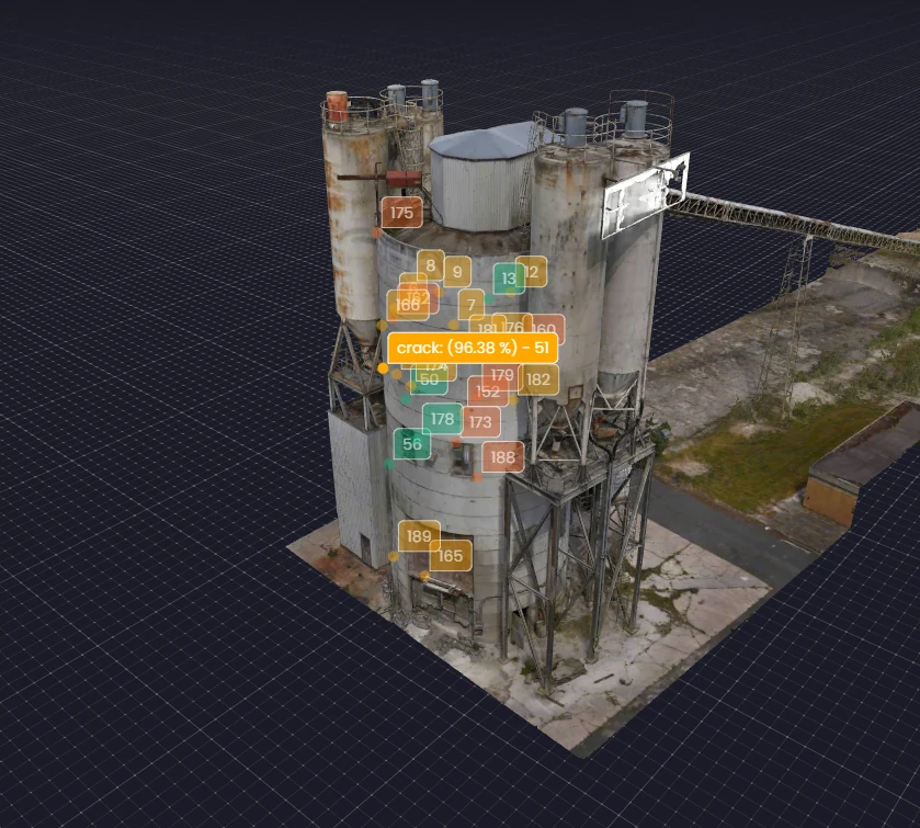
AI defect detection, geolocated on the model
Every image analysed for cracking, spalling and corrosion down to 0.2 mm, then pinned to its exact position on the digital twin — and handed back as a geolocated PDF report your team can open and act on immediately, not just coordinates locked inside a 3D model file.
What the model finds
AI drone defect detection uses a drone to photograph a structure, then a trained model finds and measures cracks, spalling and corrosion — delivered as a geolocated PDF report plus a 3D model. The detection pipeline identifies cracks from 0.2 mm — below what a ground-level visual pass reliably catches — using a model trained and benchmarked specifically on infrastructure surface defects.
Detections are not left floating in photographs. Each one is projected onto the reconstructed model, so a crack has coordinates, a member, and a chainage — and the next capture cycle can measure whether it moved.
Why the PDF report matters as much as the model
A register that only exists as points on a 3D model needs the right software — and usually a laptop — before anyone can open it. Every job also ships as a geolocated PDF report: photos, severity, chainage and location plotted on plan, readable on a phone in a site shed with no CAD licence or model viewer required. The 3D model is still there for whoever wants to interrogate it further; the PDF is what most people actually open first.
| Minimum crack width | 0.2 mm |
| Detection classes | CRACKING · SPALLING · CORROSION STAINING |
| Output | GEOLOCATED PDF REPORT + 3D MODEL |
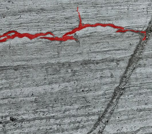 DETECTION CROP
How it works
- 01
Systematic capture
Full-coverage imaging at fixed standoff and resolution — every face, repeatable waypoints.
- 02
Reconstruction
Imagery is built into the 3D model that becomes the spatial index for every finding.
- 03
AI detection
Each frame is analysed for defect classes down to 0.2 mm and scored.
- 04
Geolocated register
Findings are pinned to the model and issued as a register your engineer reviews, filters and signs off.
Built to support the engineer — never to replace them
The register is evidence, not judgement. Severity classification, intervention decisions and sign-off remain with the responsible engineer; what changes is the quality of what they are signing off on — complete coverage, consistent resolution, and findings they can open at full resolution on the model.
Because capture waypoints repeat exactly, cycle-on-cycle comparison becomes measurement rather than opinion: the same face, the same standoff, a year apart. The flying itself is standard close visual inspection work — the intelligence layer sits on top.
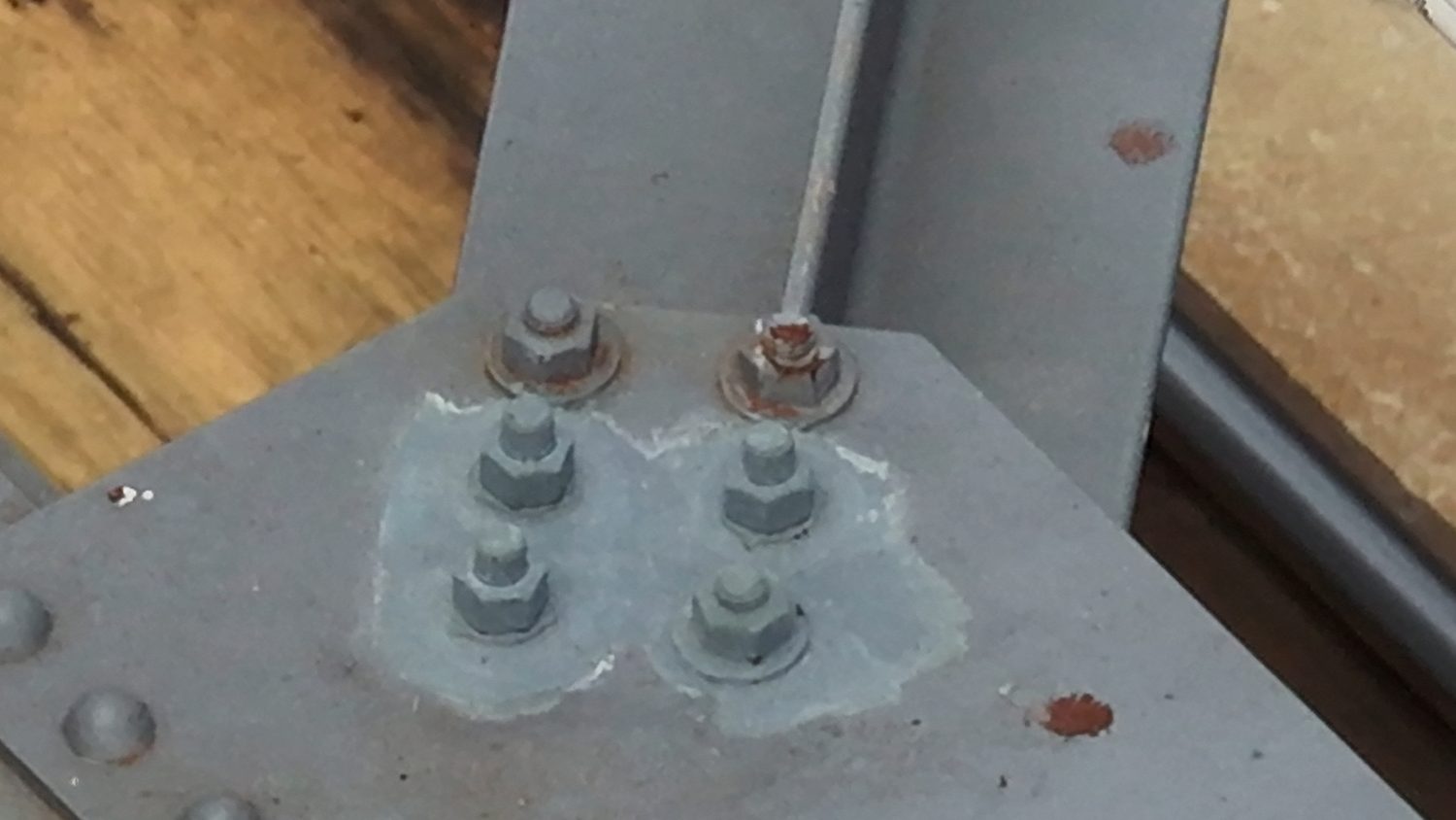 FINDING — CORROSION
Straight answers, before you ask
Q/01How small a defect can the AI detect?
Cracks from 0.2 mm width, given capture at the designed standoff and resolution. Every automated finding remains reviewable at full image resolution, so your engineer verifies rather than trusts.
Q/02Does this replace an engineering inspection?
No. It replaces the data-gathering: the access hire, the working-at-height exposure, the sampling compromises. Assessment, severity classification and sign-off stay with the responsible engineer — the register is structured to make that review faster, not to shortcut it.
Q/03Which assets does it suit?
Concrete and steel structures where surface condition drives maintenance: bridges, dams and spillways, towers, wharves, facades and industrial plant. If reconstruction can see the surface, the pipeline can index it.
Q/04What makes the results repeatable?
Capture runs on fixed waypoints at fixed standoff, so each inspection cycle images the same surfaces the same way. Comparing registers between cycles shows genuine change — new defects, crack progression — rather than differences in how the photos were taken.
Q/05Do I get a model file, or something I can just open?
Both. Every job ships as a geolocated PDF report — photos, severity and location plotted on plan, no software required — alongside the underlying 3D model and a CSV/GIS register for anyone who wants to work with the data directly. Most engineers open the PDF first and only drop into the model when they need to measure something themselves.
Q/06How much does AI defect detection cost?
It is scoped on the asset — its size, access and how much surface needs analysing. As a guide, a single-structure inspection with AI defect reporting typically runs from the low four figures upward. See the drone survey cost guide for the full picture; Hover returns a written, fixed quote within one business day.
Scope this for your site
Send the asset and the deliverable you need — a scoped method and quote comes back within one business day.
HARRY BILLING — CHIEF REMOTE PILOT
0411 445 458
[email protected]
CASA ReOC #9398 · $20M PUBLIC LIABILITY