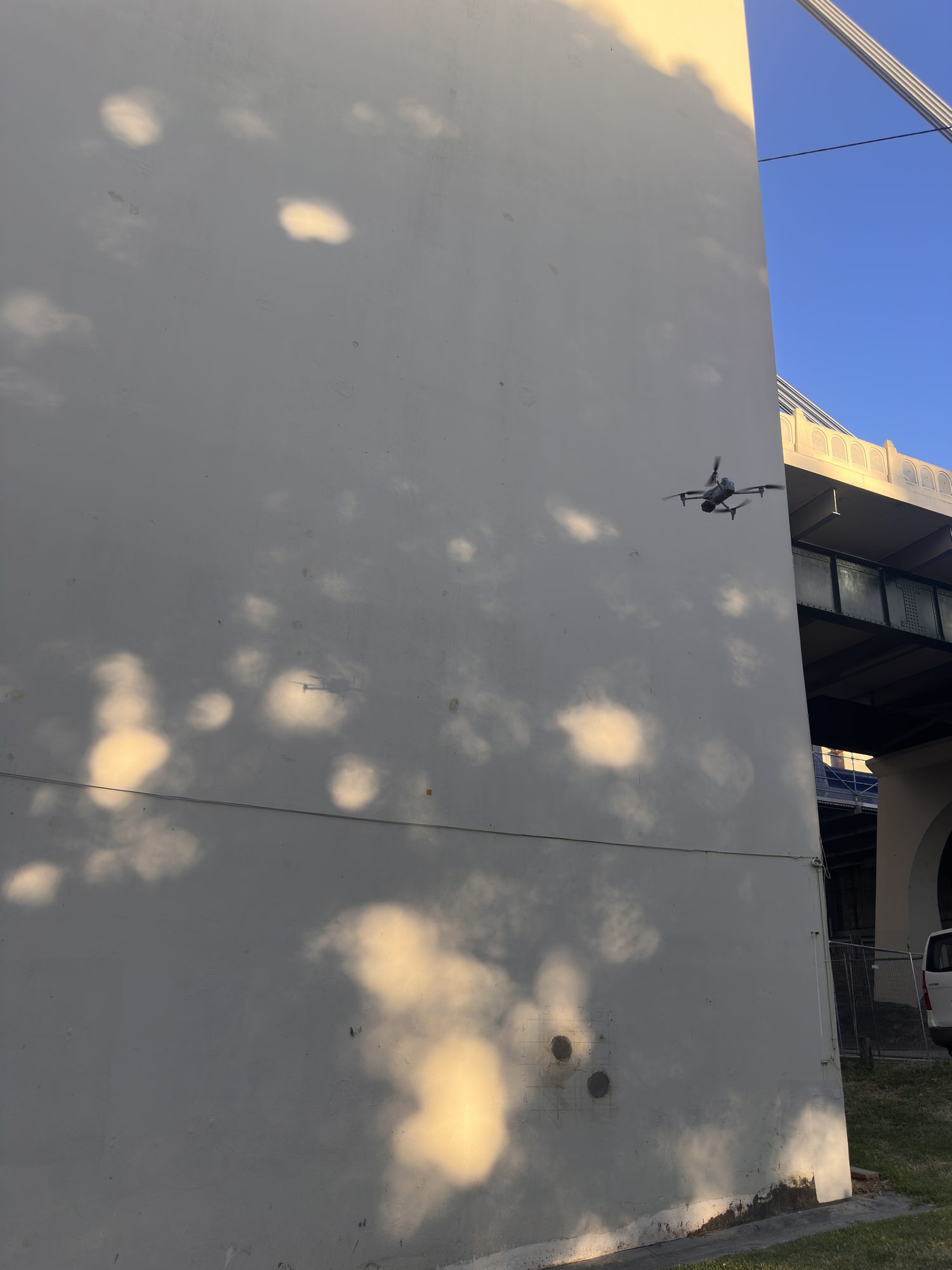
Drone inspections across Brisbane
CASA-certified inspection of bridges, towers, dams, roofs and facades — findings delivered as a geolocated PDF report you can open on site, backed by a measurable 3D model.
What a Hover drone inspection is
Hover Aerial Imaging provides CASA-certified drone inspections across Brisbane and South East Queensland — bridges, telecommunications towers, dam faces, roofs, facades and industrial plant. Every asset face is captured from safe standoff at sub-millimetre detail, then handed back as a geolocated PDF defect report plus a 3D model you can measure. One accountable operator plans and flies each job; nothing is subcontracted. Insured to $20M, controlled-airspace approved, mobilised across SEQ and beyond.
What we inspect
If condition matters and access is the expensive part, a drone captures it faster, safer and more completely than rope access or an EWP.
Bridges & structures
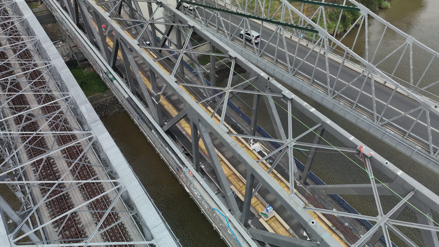
Road and rail bridges, soffits, bearings, upper members and truss nodes — the faces a ground crew samples at best. Under-deck and over-water access without a snooper truck or lane closure.
Towers & comms
Telecommunications, transmission and monopole towers inspected in place — antennas, mounts, welds and coatings — with no climb crew and no shutdown.
Dams & spillways
Concrete faces, spillway chutes and outlet works imaged end to end for cracking, spalling and vegetation ingress — including areas unsafe to reach on foot.
Roofs & facades
Commercial and industrial roofs, cladding and building facades documented without scaffold or harness — ideal for defect assessment and dilapidation records.
Industrial plant
Silos, stacks, conveyors and process structures captured at height while operations continue below, with findings pinned to a 3D model.
Hard-to-reach assets
Over water, at height, in live corridors — anywhere putting a person is slow, costly or dangerous. If the surface is visible, it can be captured.
A report you can open on site — not just points on a model
The inspection doesn't end at a 3D model that needs specialist software to open. Every finding is written to a geolocated PDF report your engineer, asset manager or contractor can read on a phone at the asset — each defect referenced to exactly where it sits on the structure.
Behind the PDF sits the full evidence: the measurable 3D model, the annotated image set, and a CSV/GIS register for your asset system. Pair the flight with AI defect detection and cracks resolve from 0.2 mm; step up to a LOD 400 digital twin when you need the geometry as well as the condition.
| Primary output | GEOLOCATED PDF DEFECT REPORT |
| Evidence | 3D MODEL + ANNOTATED IMAGE SET |
| Register | CSV / GIS DEFECT LIST |
| Crack resolution | FROM 0.2 MM (WITH AI DETECTION) |
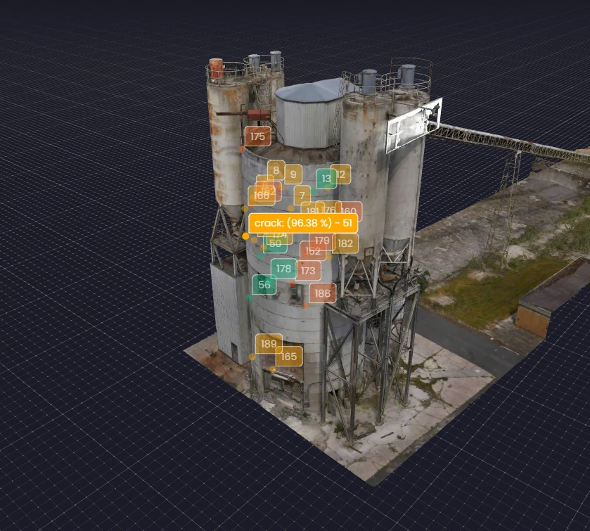 OUTPUT — DEFECT OVERLAY
What the drone replaces
A conventional close inspection is mostly the cost of access: rope crews, scaffold, EWP hire, traffic control and permits — with people working next to the thing being inspected. Flown from standoff, the same coverage arrives without the exposure and without shutting the asset.
The result is complete — soffits, upper members and dam faces that ground passes can't reach — repeatable to the same waypoints next inspection cycle, and dated for your records. See the depth on the close visual inspection page.
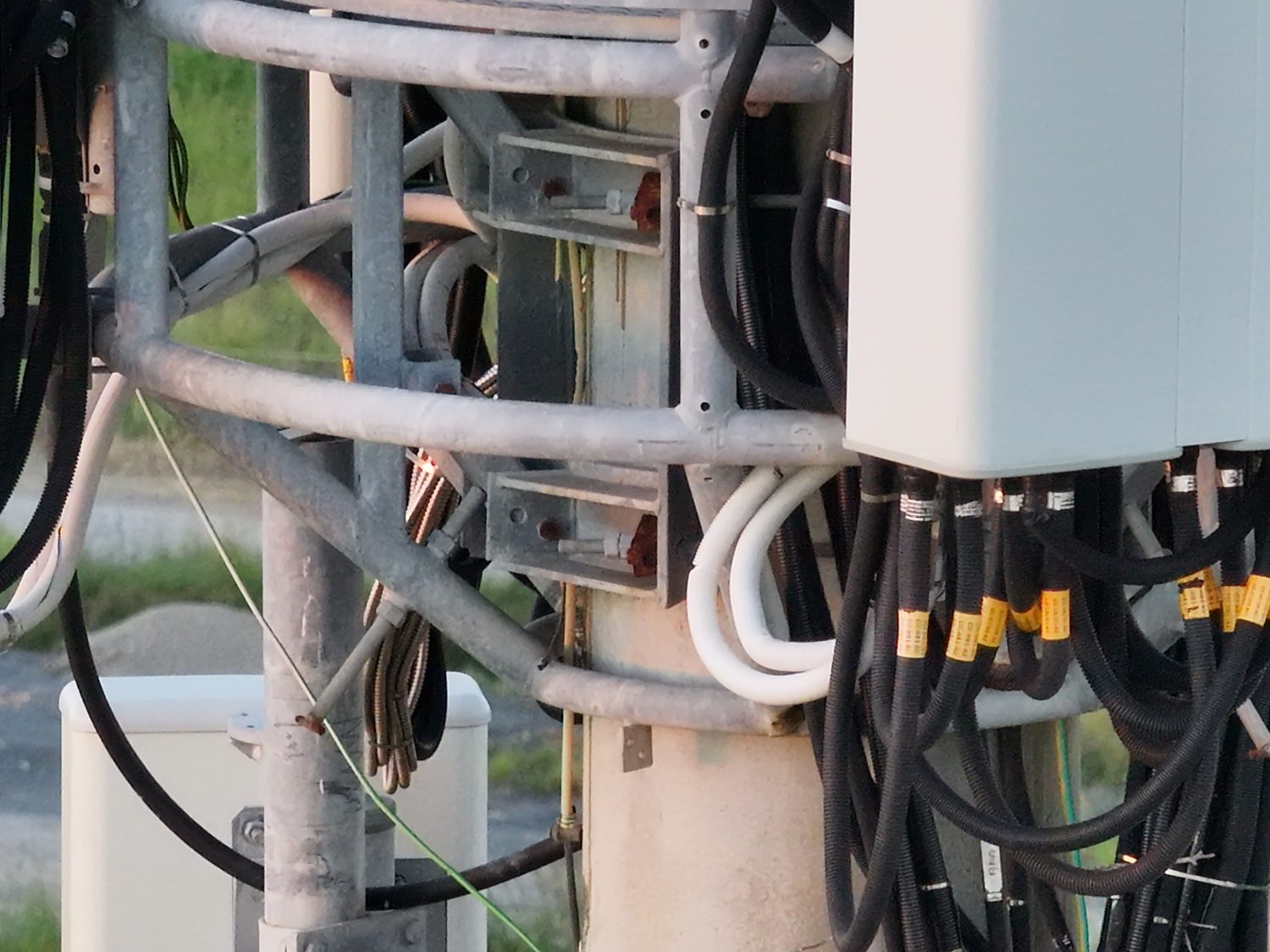 ASSET — COMMS TOWER
Inspections we've flown
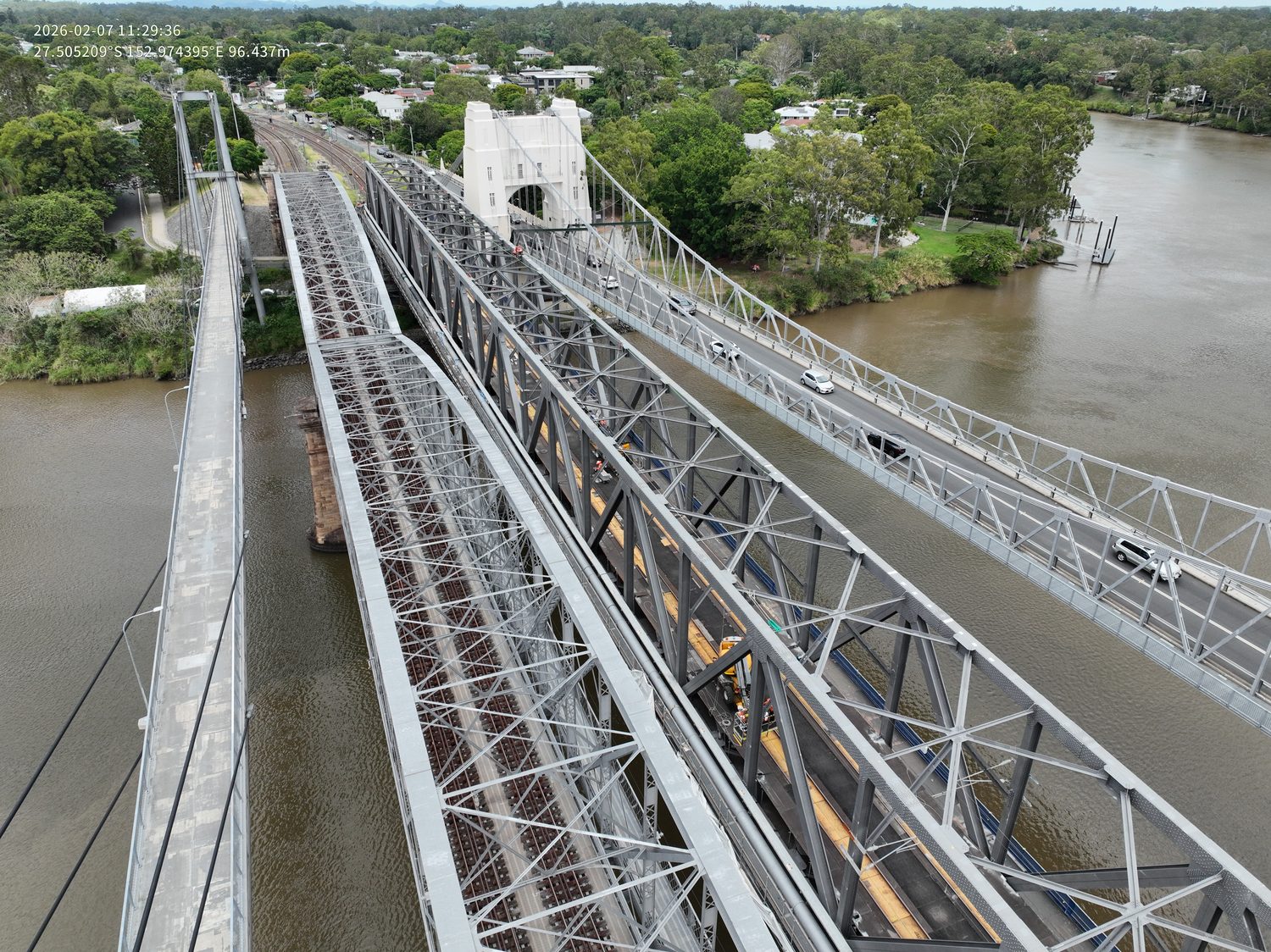
Real infrastructure across Brisbane and Queensland — from a live rail-possession bridge inspection to an under-deck program on the Story Bridge.
Brisbane, the coasts and beyond
Home base is Brisbane. Greater Brisbane, Ipswich, Logan, Moreton Bay and Redlands are standard local mobilisations, and the Gold Coast and Sunshine Coast are within routine reach. Controlled-airspace inspections — including around Brisbane CBD and near the airport — are arranged under CASA approval. For assets further out, see regional QLD & Northern NSW and nationwide major projects.
Drone inspection questions, answered
Q/01What assets can you inspect by drone?
Bridges, telecommunications and transmission towers, dam faces and spillways, roofs and facades, wharves and industrial plant. If the surface is visible from a safe standoff, it can be inspected — most structures across Brisbane and South East Queensland are within scope, including assets in controlled airspace.
Q/02How much does a drone inspection cost in Brisbane?
Price depends on the asset, access and the deliverable. Simple single-asset visual inspections in Australia typically start in the several-hundred-dollar range, while large or complex structures with full AI defect reporting run into the low thousands. Because scope varies with access and what you need at the end, Hover returns a written, fixed scope and price within one business day rather than publishing a fixed list.
Q/03What do I receive after the inspection?
A structured, referenced image set of every face, plus a condition summary. Paired with AI defect detection, findings arrive as a geolocated PDF report — readable without specialist software — with each defect pinned on a measurable 3D model and listed in a CSV/GIS register.
Q/04Are you CASA certified and insured?
Yes. Hover operates under CASA ReOC #9398 with $20M public liability. SWMS, insurances and operating certificates are supplied ahead of mobilisation, and controlled-airspace approvals — including around Brisbane CBD — are arranged as part of planning.
Q/05Can you do roof and dilapidation inspections?
Yes. Drone capture documents roofs, facades and pre- and post-construction condition without access equipment, producing dated, geolocated imagery suitable for dilapidation records and defect assessment. Hover provides engineering and asset-condition data; it is not a registered building certifier.
Scope an inspection for your asset
Send the asset, its location and what you need to know — a scoped method and quote comes back within one business day.
HARRY BILLING — CHIEF REMOTE PILOT
0411 445 458
[email protected]
CASA ReOC #9398 · $20M PUBLIC LIABILITY