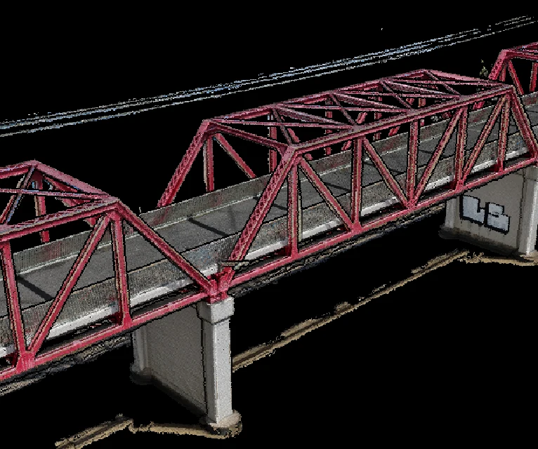
Photogrammetry and LOD 400 digital twins
Millimetre-textured, measurable 3D models of your asset — RTK-positioned, validated against ground control, and delivered in the formats your design team already runs.
What lands on your desk
Drone photogrammetry turns overlapping aerial photos into a measurable, textured 3D model — an LOD 400 digital twin accurate enough for engineering, delivered in the formats your design software already reads. Every capture is processed into a validated model set, packaged with a control report so your engineers can verify the accuracy claim instead of taking it on trust.
| Textured mesh | .OBJ / .FBX |
| Point cloud | .LAS / .RCP |
| Orthomosaic | GeoTIFF |
| Surfaces | DTM / DEM |
| Validation | GCP CONTROL REPORT — PDF |
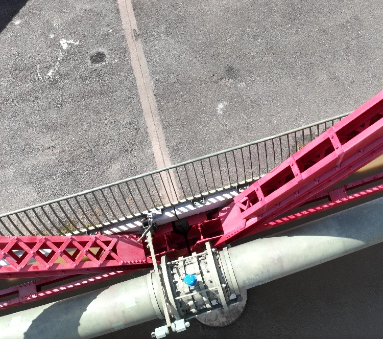 MESH DETAIL — LOD 400
How accurate is it, really?
RTK corrections tie every image to survey control as it is captured: up to 1 cm + 1 ppm horizontal and 1.5 cm + 1 ppm vertical. Independent ground control points then check the model rather than shape it — the residuals go in your report.
On structures, relative accuracy runs 3–5 mm, which is what matters for clearance checks, deformation baselines and fit-up.
The honest limitation: photogrammetry needs to see the surface. Dense canopy and open water break reconstruction — if your site has either, we tell you before we fly, not after.
| Horizontal accuracy | Up to 1 cm + 1 ppm |
| Vertical accuracy | Up to 1.5 cm + 1 ppm |
| Relative (structures) | 3–5 mm |
| Validation | INDEPENDENT GCPs, EVERY JOB |
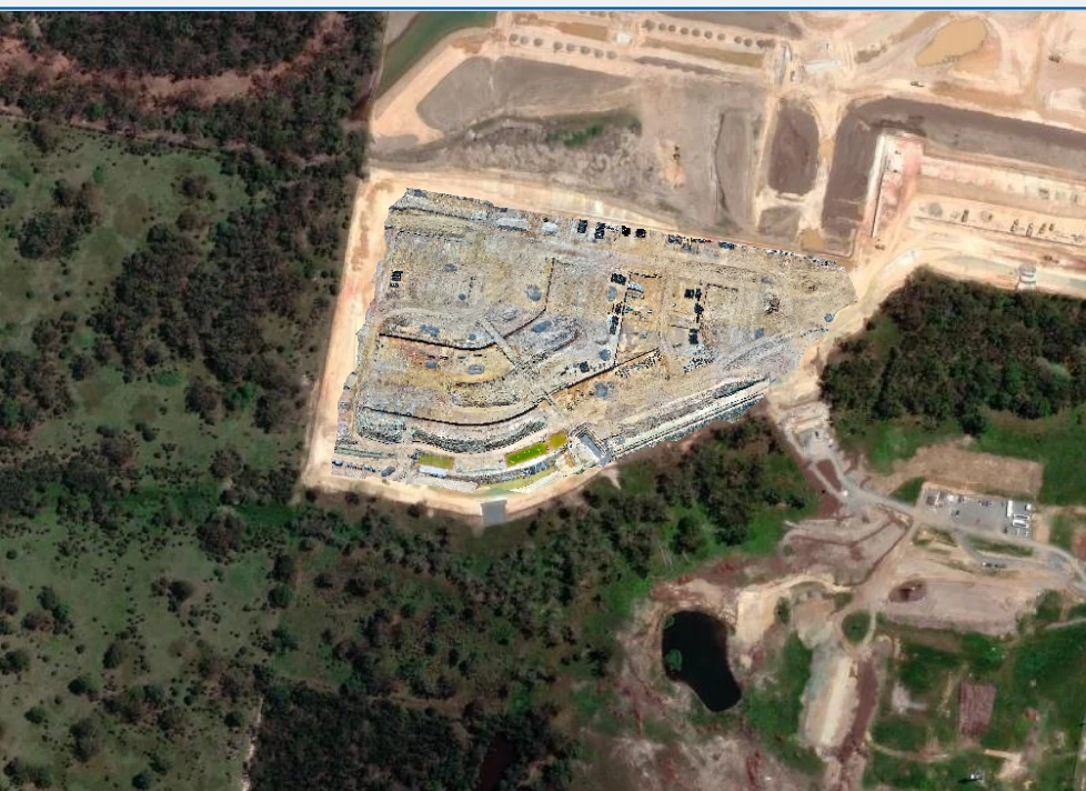 CONTROL OVERLAY
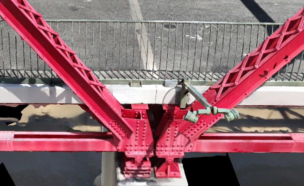
The twin holds up at rivet scale
Left: the drone photograph. Right: the same truss node inside the LOD 400 model. Measure either one.
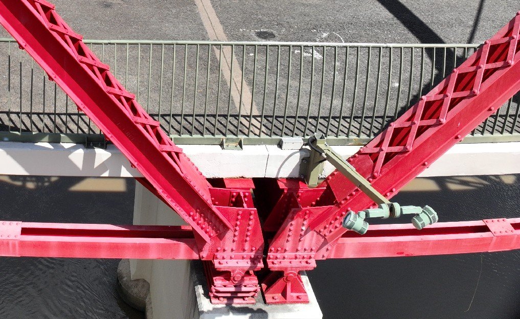 SITE PHOTO
 DIGITAL TWIN — MESH
Where photogrammetry beats a ground crew — and where it does not
A drone captures the full asset — every face, every elevation, the roof nobody has photographed since construction — in hours, from safe standoff, with no plant hire and no working-at-height exposure. The result is a complete, revisitable record rather than a folder of point measurements. Pair the capture with AI defect analysis and the record starts finding problems for you.
It is not the tool for everything. Under dense canopy a ground survey wins. And boundary or cadastral work is legal survey territory: that belongs with a registered surveyor, and we say so up front.
Four steps, no mystery
- 01
Flight and control plan
Capture geometry, GSD and GCP layout designed around your accuracy spec and site constraints.
- 02
RTK capture
Base station on known control; every frame position-stamped at capture.
- 03
Reconstruction and validation
Model built, then checked against independent GCPs. Residuals recorded.
- 04
QA and delivery
Formats cut to your stack — with the control report attached.
Straight answers, before you ask
Q/01How accurate is drone photogrammetry?
With RTK corrections and ground control validation, our surveys achieve up to 1 cm + 1 ppm horizontal and 1.5 cm + 1 ppm vertical accuracy, with 3–5 mm relative accuracy on structures. Every delivery includes the control report showing the residuals, so the accuracy claim is verifiable rather than asserted.
Q/02What is a LOD 400 digital twin?
LOD 400 is a level-of-development standard from BIM practice: the model is detailed enough to measure fabrication-level geometry — individual members, connections, fixings — not just overall shape. It means your engineers can take dimensions from the model with confidence instead of revisiting site.
Q/03What software does the data work with?
Deliverables drop straight into Civil 3D, 12d, Revit, OpenRoads, Trimble Business Center and standard GIS platforms. We cut .LAS, .RCP, .OBJ, .FBX, GeoTIFF and DTM/DEM surfaces to suit your workflow — no conversion step on your side.
Q/04How long does a capture take?
Most single structures are captured in one site visit; processing time scales with area and resolution. You get a scoped timeframe with the quote, and the deliverable arrives with its validation report — we do not release unchecked models.
Q/05Do you use LiDAR?
No — we run photogrammetry. For textured, inspectable digital twins at this accuracy class, photogrammetry delivers the visual detail LiDAR cannot: every rivet, stain and crack is in the model, not just its geometry. Where a project genuinely needs LiDAR, we will tell you that too.
Q/06How much does a drone digital twin cost?
A single-structure LOD 400 digital twin typically starts around $1,000 and rises with size, complexity and access. See the drone survey cost guide for how the number is built up; Hover quotes each job in writing within one business day.
Scope this for your site
Send the asset and the deliverable you need — a scoped method and quote comes back within one business day.
HARRY BILLING — CHIEF REMOTE PILOT
0411 445 458
[email protected]
CASA ReOC #9398 · $20M PUBLIC LIABILITY