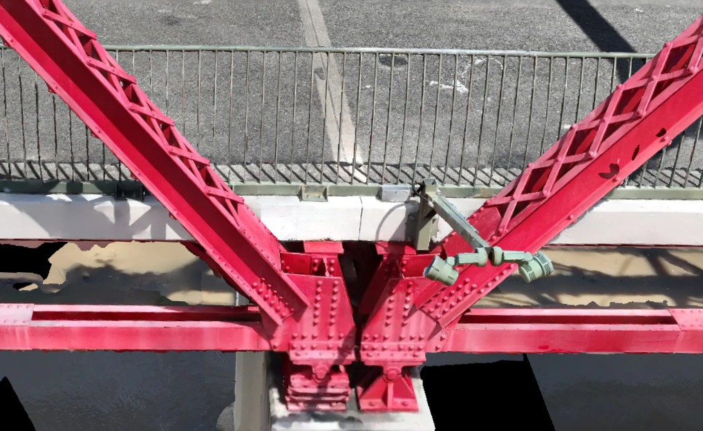
What a digital twin actually is
Strip the buzzword back and a digital twin is simple: a three-dimensional, dimensionally accurate, photographically textured model of a physical asset, current as of the day it was captured. Not an artist impression and not a design model — a measurement of what is actually standing on site, down to individual members, connections and surface condition.
The level-of-development language from BIM practice is useful here. An LOD 400 twin carries fabrication-level detail: your engineers can take a dimension off a gusset plate in the model with the same confidence as a tape measure on site — because the model was validated against surveyed ground control when it was built.
How one gets made
The workflow has three stages. First, capture: an enterprise RTK drone platform flies a designed pattern around the asset, recording hundreds or thousands of overlapping images, each position-stamped to centimetre accuracy against a base station. Second, processing: professional photogrammetry software matches features across the images and reconstructs them into a point cloud and a textured mesh, which is then checked against independently surveyed control points. Third, delivery: the validated model is cut into the formats your team works in, with the control report attached.
For a single structure, capture is typically one site visit. Nobody climbs anything, no plant is hired, and the asset keeps operating underneath. The full method sits on our photogrammetry and digital twins page.
Where the money actually comes back
Fewer site visits is the first and largest saving. Every question that can be answered from the model — a dimension, a clearance, a condition query, a constructability check — is a trip, a permit, and a slice of risk exposure that never happens. On regional assets the arithmetic is brutal: one avoided mobilisation can exceed the cost of the twin.
Remote measurement is the second. Once the twin exists, anyone with access can measure anything on the asset, at any time, without a booking. Design teams stop working from decade-old drawings that no longer match reality.
The condition record is the third. A twin is a timestamp: the asset exactly as it stood on capture day. Repeat the capture next year and change becomes measurable — settlement, corrosion growth, works progress — rather than argued about from mismatched photographs.
Safer, cheaper access planning is the fourth. Scaffold and rope-access designers can plan from the model — virtual scaffold design against real geometry — so crews arrive with a design that fits first time.
Clash detection is the fifth. Drop the twin into the same environment as the as-designed CAD and mismatches between drawing and reality surface on a screen, before they surface as a variation claim.
Formats and software: it has to fit your stack
A twin that fights your software is a twin that goes unused. Deliverables should arrive as textured mesh (OBJ or FBX), point cloud (LAS or RCP), and georeferenced imagery — formats that drop directly into Revit, Navisworks, Bentley environments and Civil 3D without a conversion project. If a provider cannot tell you exactly which formats you will receive and what software they open in, keep shopping.
Lifecycle management: the twin as an asset, not a file
The highest-value twins are the ones that get updated. A capture at handover establishes the baseline; scheduled recaptures at inspection intervals build a condition history that turns maintenance planning from reactive to evidenced. Because our capture runs on fixed, repeatable parameters, each cycle is directly comparable with the last — the same faces, the same resolution, years apart.
For Brisbane and South East Queensland assets, that program can start with a single structure; our Brisbane operations page covers mobilisation, airspace and what a first capture involves.